Penticton is British Columbia's city of events which include the Penticton Peach Festival, the Ironman Triathlon, Okanagan Wine Festival, the Elvis Festival and Children's Festival. It is also a city for outdoor adventure with its ideal weather conditions.
Nestled in a valley between mountains and two lakes it offers boating and fishing on both Skaha and Okanagan Lakes, kayak rentals, parasailing, kite surfing and other water sports. There are eighty-eight wineries within an hour's drive of Penticton, golfing, hiking, cycling, rock climbing, horseback riding, museums and galleries to visit, parks and biking the Kettle Valley Railway Trail. And my all-time favorite, a lazy float down the Channel on inner tubes with friends and a necessary beverage of your choice. It is approximately a one and a half hour float to about the half-way point where a bus will pick you and your tubes up and return you to your car. To go the entire way to the lake entrance will take over three hours of wonderful floating pleasure.
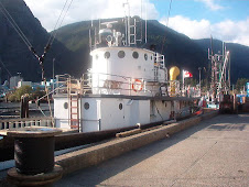
There is something for everyone in this Okanagan city – water slides, Apex Mountain recreation area or the boutiques and unique shops, some in original buildings dating back to the early 1900's. There is also the S.S. Sicamous to tour, a historic paddle wheeler located on the south shore of the Okanagan Lake.
Another great adventure is a trip on the Kettle Valley Railway steam train. This 1912 restored steam locomotive will take you on a ninety minute journey through orchards and vineyards with a view of the lake. Events such as the Great Train Robbery will be held where you'll meet the notorious Garnett Valley Gang. This trip will include a barbeque dinner with musical entertainment.
Another interesting feature of a visit to Penticton is the possibility of seeing Ogopogo of Lake Okanagan. It is suspected of being twenty to fifty feet long with an undulating serpent-like body. Local Aboriginal people reported sightings many years prior to the first Caucasian sighting in 1870 and reports of sightings continue to this day. Ogopogo has been reported to be seen from as close as fifty to one hundred feet away. It is said that this lake creature can move with astounding speed.
Is it real or a myth? Of the numerous people who swear to have seen it, they say it is real. But on a visit to Penticton, you will probably arrive with a healthy dose of skepticism but your eyes wide open – just in case you have a story of a life-time to tell on your return home. We never have seen Ogopogo on any of our visits but I haven't completely relegated the story to that of being a myth.
Penticton, because of its wonderful weather conditions, is great for growing luscious fruit, particularly peaches so it's an ideal opportunity to load up your trunk with some of the bounty on your visit. Accommodations are also readily available.
On a visit to our beautiful province of British Columbia, Penticton with all it has to offer, is not a place to miss.
Monday, August 15, 2011
Thursday, August 11, 2011
Palm Springs in the Coachella Valley
Palm Springs, a desert city within the Coachella Valley, is a great destination for golfers with its 125 golf courses. But there is more to this lovely area than just golfing. For those who like the desert air there are many other attractions as well.
One of the particularly interesting places to visit is Joshua Tree National Park with its abundance of birds, and animals such as bobcats, cougars, coyotes, quails, jackrabbits, big horn sheep and desert tortoises. Flowering cacti especially are the jewels of the park as well as the many other wild flowers that flourish in this desert area. And there are many various rock formations that are unique for the visitor to see. Also of interest, the park is crisscrossed with hundreds of fault lines. The famous San Andreas Fault can be observed on the south side of the park as well as other fault lines throughout the area.
Joshua Tree National Park has 501 archeological sites and 88 historic structures as well as a large museum collection. Included is the Pinto culture collection dated at 4,000 to 8,000 years ago. There are collections also of tools, basketry and ceramic tools telling the story of the early lives of the Cahuilla, Chemuevi and Sorrano who occupied the park prior to the early 1900's. And the exhibits of miners' tools and children's toys tell the story of the park's early Anglo settlers. An estimated three hundred mines were developed in the area after the California gold rush of 1849 ended. Also included are photographs and old library collections of the early cattlemen in the area.
Soak City is another attraction with many different kinds of water slides available for children or the young at heart. While we were in Palm Springs recently we took advantage of the opportunity to go. Besides the water slides, I particularly enjoyed the wave pool and the large lazy river where you don't have to do anything but relax and float along on a big tube. There are tubes available for use while you are in the wave pool also.
The Palm Springs Aerial Tram will take you up Chino Canyon where it is about thirty degrees cooler with an elevation of 8,516 feet and into Mt. San Jacinto State Park. It is a popular hiking area with sub-alpine forests, ferny mountain meadows and granite peaks. The Mt. San Jacinto State Park has been likened to hiking in Switzerland. In the winter cross-country skiing and snowshoeing are popular sports. Completed in 1963, the Aerial Tram has carried more than twelve million people into the mountains overlooking the Coachella Valley.
The Palm Springs area has a high of approximately 104 degrees in the summer although when we were there recently it reached 115 degrees. We were thankful for the backyard pool and air conditioning.
Although we usually visit Palm Springs during the summer months, the ideal time is during the other seasons when the temperatures are lovely but a little more moderate especially if you are there for the golf games.
The Magic World of Disneyland
Walt Disney's dream came true when he opened Disneyland Park in California. In his own words, the secret of making dreams come true is curiosity, confidence, courage and constancy. And Disneyland is all about dreams.
Disneyland was started by a mouse debuting as Steamboat Willie. Mickey Mouse first appeared in 1928. In 1937, Walt Disney produced Snow White and the Seven Dwarfs and later went on to produce Pinocchio, Fantasia, Dumbo and Bambi. Walt Disney's name is synonymous with imagination and creation. And in his own words, 'nothing is impossible.'.
On a recent visit to this fairyland amusement park, although Bambi was not in evidence, Dumbo flew around Fantasyland carrying happy, laughing children and their parents. And on a ride through the forest we visited the home of the seven dwarfs and witnessed the 'happily ever after' story of Snow White.
In Toontown Mickey Mouse, Walt Disney's first loveable cartoon character meets and greets visitors to the park along with Goofy and Donald Duck allowing ample opportunities for photos to be taken.
Disney worked endlessly in the early years to perfect the art of animation. Technicolor was first introduced to his animations in his production of Silly Symphonies. On Paradise Pier the Silly Symphony swings now take guests for a spin over the boardwalk. Also in this area of California park the World of Color display of colored dancing lights with animated characters are no doubt in memory of Disney's Wonderful World of Color production of 1961. Although Disney died in 1966, he definitely has not been forgotten and is thought of as a bridge from the past to the future.
A visit to Disneyland is, as Disney planned, an exciting experience for both adults and children alike. Among my favorite rides are Pirates of the Caribbean which opened in 1967 and was one of the last Disney was involved with before his untimely death; the haunted mansion, although not introduced to the park until 1969 was an idea conceived many years previously by Walt Disney, and It's a Small World which was added in 1964. Another favorite, although a much more recent addition, is Soaring over California which takes riders on a hang glider flight over the Golden Gate Bridge, Yosemite National Park, Lake Tahoe and San Diego harbor to name a few of the beautiful sights you will see as the breeze caresses your face and gently blows through your hair. Other favorites are Grizzly River Run, the Jungle Cruise and Peter Pan's Flight. Tower of Terror, a relatively new addition is not a favorite of mine, nor California Screaming but were rides my sons went on several times.
Disneyland and California Adventure Parks are a combination of adventure, magic and dreams. The results of Walt Disney's dreams are where every adult can be a child again and every child can believe in the impossible.
San Felipe and the Baha Peninsula
The Baha Peninsula extends approximately 1,200 km from the US border to the southern tip. It is separated from Mexico by the beautiful azure blue Sea of Cortez and is mainly desert and mountains.
The Peninsula is made up of four deserts: the San Felipe Desert, Central Coast Desert, Vizcaino Desert and the Magdalena Plain Desert. In 1952 the North Territory of Baja California became the 30th state of Mexico known as Baja California and the South territory of Baja California became the 31st state known as Baja California Sur.
On the Peninsula, Tijuana, a border city is famed for its international cuisine, Ensenada is surrounded by vineyards, at Scammons Lagoon you may be lucky enough to spy a Gray Whale, Rosarito is the top destination for scuba diving and La Paz is popular for sport fishing and windsurfing. Los Cabos, in the southern part of the Peninsula is one of Mexico's most popular destinations.
The Peninsula was discovered by a sea captain, Hernan Cortes in 1535. He made the first detailed map of the area and gave the town of San Felipe its original name of Santa Catalina. In 1766 Wenceslaus Linck was the first person to reach by land what later became known as San Felipe. San Felipe, with its fantastic fall, winter and spring weather is only two and a half hours from the US border. A unique town, it is the shrimping capital of the Baha.
On a recent trip to San Felipe we watched the shrimp boats ride up onto the sand as they came into shore to unload their daily catch of fresh caught shrimp. And fresh they are! We had shrimp tacos with a large array of condiments and sauces and I can honestly say there is nothing that tastes quite as good. Combine that with a cold glass of the local beer and fresh squeezed lime juice and you have a lunch fit for a king.
While there we also visited the Valley of the Giants. It is a natural reserve of one thousand plus year old cardones cacti. They are native to the area and during their span of life have witnessed the passing of time and no doubt many changes. Their roots can spread up to thirty meters to trap water after one of the area's infrequent rainfalls. Sometimes they trap enough water to allow them to survive for years. When standing beside any of these amazing giants, some as high as fifteen meters, any man will be dwarfed by their size.
There are interesting shops in the town of San Felipe, Mexican-style Mardi Gras', festivals, fishing, night life and friendly people. It has the reputation of being the second sunniest place on the planet. Beachcombing is an adventure too as the tide goes out a long way. And dozens of camping spots can be found almost anywhere you look.
San Felipe, like much of the Baja Peninsula is a veritable paradise, a vacationer's dream spot with its ideal weather conditions, unique beauty and the allure of the crystal blue waters of the Sea of Cortez.
Wednesday, August 3, 2011
The Othello Tunnels of British Columbia
The Othello Tunnels are located in the most rugged section of the Coquihalla Canyon. At a time when there was limited technology, tunnels were created through three solid granite mountain cliffs and bridges were built above a canyon where the river rushes three hundred feet below. It is a terrain so rugged as to seem nearly impossible even with the technology we now have.
This magnificent and unbelievable engineering feat was designed by engineer Andrew McCullough and was completed between 1911 – 1918. Sadly many immigrants lost their lives during the building of these tunnels and trestles which were deemed necessary to gain passage to the coast. Once British Columbia became part of Canada in 1871, it was necessary to link eastern Canada to the Pacific Coast. The mountains of British Columbia were a challenge, particularly those surrounding the Coquihalla Gorge. There was no way around so the engineer for the project made the decision to go through. McCullough was hired as the chief engineer in May, 1910, more than one hundred years ago. The work was completely done by hand with some help from horse drawn scrapers and black powder. Cliff ladders, suspension bridges and ropes assisted the workers in building what, even today, is considered an engineering marvel.
At the time the tunnels and passage were built, they cost $300,000.00. In today's money it would translate into approximately $5.8 million dollars. The old CPR Kettle Valley Railway once ran through this magnificent piece of history and through some of the most beautiful scenery there is in the province.
The tunnels, also known as the Quintette Tunnels, were named by Andrew McCullough who was an avid fan of Shakespeare. He used the names of Lear, Jessica, Portia, Iagy, Romeo and Juliet to name the stations on the Coquihalla route.
It was thirty-eight miles from the Coquihalla Summit to the junction with the CPR mainline across the Fraser River from Hope. It ran freight and passengers between Nelson and Vancouver but was often plagued with rock and snow slides. The Kettle Valley Railway closed in 1959 following a severe slide in the area and in May of 1986, the tunnels and surrounding area became a provincial recreation area.
Today, after walking through the tunnels and traversing the bridges, you can continue along the old railroad bed which links to the historic Hope-Nicola Cattle Trail. Many visitors take their bikes to travel the path left by a railway that is no longer available to us.
The park is closed between November and March each year because of the possibility of falling rocks and ice breaking from the surface of the walls of the canyon to the walking trails below. When visiting the tunnels, it is necessary to take a flashlight. It is important to remember also that bikes must be walked and pets must be kept on a leash at all times.
A visit to the canyons is well worth the drive for the beauty, the wonder and the amazement of what man is capable of doing. Like other men of vision, Andrew McCullough believed anything was possible.
The Majestic Grand Canyon
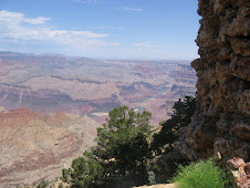
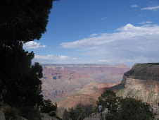
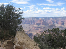
When seeing the Grand Canyon for the first time one is at a loss for words or even unable to comprehend the unbelievable wonder of its creation. It is such a spectacular sight that no picture can possibly do it justice.
Few people have not seen pictures of the Grand Canyon and still when we first see it, we cannot be anything else but impressed and in awe of this majestic sight. What then must it have been like for the first people who happened on this unbelievable vision of nature at its best?
The oldest human artifacts discovered date to the Paleo-Indian period nearly 12,000 years ago. For thousands of years the Puebloans, Cohoninas, the Paiutes, Cerbats and the Navajoes lived as semi-nomadic hunter-gatherers and canyon dwellers in the area of the canyon.
There are approximately 2,000 known archaeological sites within the park boundaries giving evidence of their existence and their way of life. The most accessible site is Tusayan Pueblo believed to be constructed sometime around 1185 and possibly housing about thirty people. There is further evidence that in the late 1200's these nomadic people seemed to have left the area of the canyon. It is thought that the mass exodus may have been due to a climate change since a lot of their existence depended upon agriculture.
Following this for a period of about one hundred years the canyon remained deserted by humans until the Paiutes, Cerbats and later the Navajoes returned to reestablish their settlements. The Dines, relatives of the Apache, later became inhabitants of the canyon as well until in 1882 when all Native Americans were forced onto reservations.
In 1540, Captain Garcia Lopez de Cardenas lead a party of Spanish soldiers into the Grand Canyon on an expedition but left believing that it was impossible to get through many of the areas within the canyon. It was another two hundred years before a second expedition arrived in the form of two Spanish priests. They were searching for a route from Santa Fe, New Mexico to Monterey, California. In 1826, James Ohio Pattie and a group of trappers reached the canyon but little is known about them. And in the mid 1800's Lieutenant Joseph Ines attempted to explore the area as well but eventually gave up his quest.
John Wesley Powell (1834 – 1902) was the first geologist to navigate the often treacherous Colorado River through the Grand Canyon studying the geology of the canyon. He later founded the U.S. Geological Society and wrote several books on the subject. His first trip was in 1869 and his second, more successful trip, was between 1871 and 1872. Others later followed him discovering and recording additional information about this fabulous creation as they went.
In 1901, the Grand Canyon Railway was established and ran between Arizona and the South Rim opening the canyon up to tourists who had previously only been able to visit by stagecoach. In 1905 a luxury hotel, the El Tovar, was opened on the South Rim and the Phantom Ranch in the Inner Gorge opened in 1922.
In May, 1933 the Watchtower at Desert View Point opened allowing visitors to see for over one hundred miles on a clear day and be able to watch the Colorado River as it winds through the canyon. The Watchtower was designed by Mary Elizabeth Colter using rock from the canyon. She insisted that the rock of the Tower blend into the rock of the canyon walls. Paintings and artwork decorate the inside walls. It is on the eastern end of the South Rim of the canyon. Standing seventy feet tall, it is thirty feet at its base. The Watchtower sits on a promontory over the canyon.
In the early 1900's, miners very quickly discovered that tourism was much more lucrative and easier than the often difficult and treacherous conditions of mining. Before long, and especially with the addition of the railroad, the Grand Canyon, with its awe inspiring views, became a popular attraction for tourists.
The Grand Canyon was given Federal protection as a Forest Reserve in 1893 and later became a National Monument. In 1919, it achieved National Park status receiving 44,173 visitors. It currently receives close to five million visitors each year.
Today the South Rim remains the most popular destination as the North Rim is more remote with fewer services. The newer addition of the Grand Canyon Skywalk, which is 4,000 feet above the Colorado River on the West Rim, has encouraged an influx of visitors to that area in recent years. It has a glass bottomed observation deck and reaches seventy feet over the canyon's rim. The West Rim is owned and operated by the Hualapai Indian Tribe.
On a recent visit to this marvel of nature, we took the shuttle from one view point to the next. Knowing a little bit about the history of one of the 7th Wonders of the World enhanced what we already considered an exciting visit from breath-stopping beauty alone. In some places the rock walls plunged to a depth of a mile below to the Colorado River. There were smiles on every face we passed as we followed paths and walked to view points. Happiness seemed to abound in this area of beauty.
When you look down into the canyon below and see the different layers of history that nature has preserved for us, it puts life into perspective. On a visit to many places you feel you're glad you came and you enjoyed what you saw but may not come back. But on a visit to the Grand Canyon, you will know you definitely want to return to view its beauty again.
Subscribe to:
Comments (Atom)


